

 |
| The whole party. We had spent 5 unforgettable days together in the mountains. This is a picture to look at in 10 years time! |
At the end of May 2011 I had the fortune of spending 5 fantastic days in the Drakensberg Mountains with 9 adventurous Capetownians. With 9 porters we were a big yet harmonious party. We had to endure tough weather conditions with ice cold high winds but the mind-blowing vistas made it all worth it.
If you would like to do this hike contact us at info@spanafrican-adventures.co.za or have a look at our website www.spanafrican-adventures.co.za for other exciting options.
 |
| On the path that runs from the Sentinel Car Park to the Chain Ladder. |
 |
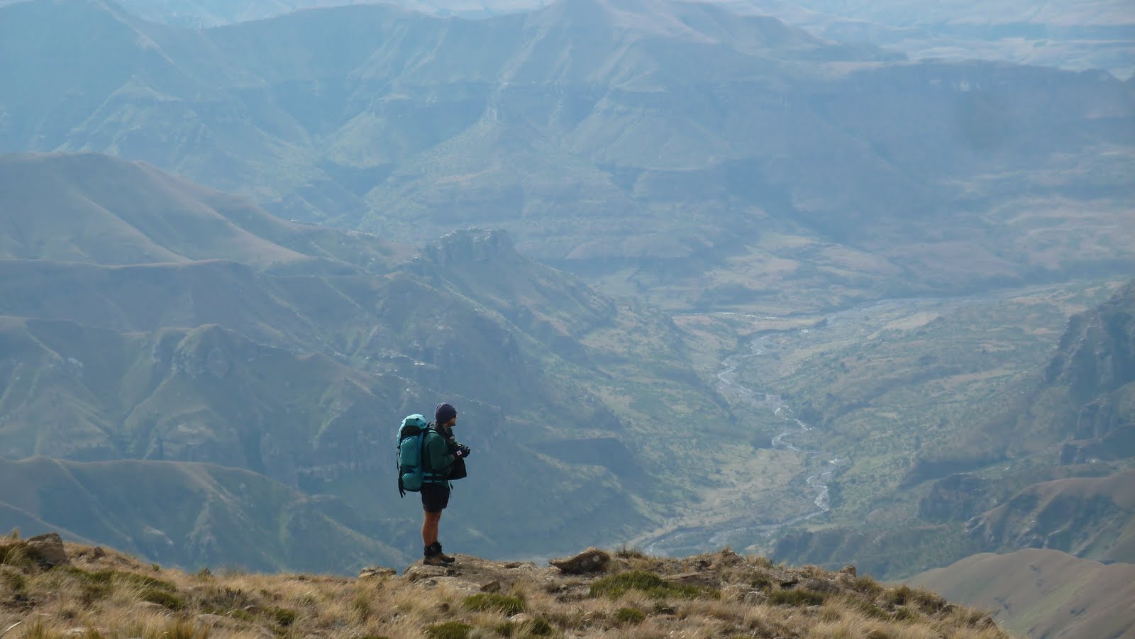
| That day the air was so clean that it looked as though you could touch the basalt cliffs on the other side of the Amphitheatre. The Devil's Tooth is the most prominent peak. |
 |
| The last stretch before the Chain Ladder with the Sentinel in the background. |
 |
| Expectantly waiting their turn up the chain ladder. Richard looked a little bit tense. |
 |
| The Chain Ladder in full display (pity of the shady bottom half). The original chain ladder has been there since 1930. It actually consists of 2 sections of 15m and 5m approximately each. Some years later, a twin chain ladder was installed. |
 |
| On the left hand side, Karen reaching the top of the first section. The second and shorter section visible on the right hand side of the picture. |
 |
| Everybody up. Good spot to cool down and let the adrenaline settle. |
 |
| Mike Strong, at 63, is still a great mountaineer. A good role model for me. |
 |
| Views of the Amphitheatre from the top of the Tugela Falls. From Left to right: Eastern Buttress, Devil's Tooth, Inner Tower and the escarpment. |
 |
| Looking down the rather empty Tugela Falls, arguably the 4th highest waterfall in the world. |
 |
| And then the sunset came and brought the usual beautiful pastel light of the winter's evenings. |
 |
| Everybody was blown away by the cold beauty of the twilight. |
 |
| This is my favourite picture of the trip. I find it so inspiring. So easy to dream with it. |
 |
| Of course, as the sun set the temperature plummeted. Gail and Maryke putting on some warm clothes. |
 |
| We had started the day rather late so it was decided to overnight by the Bilanjil Falls, 5km short from the planned campsite by Ifidi Pass. A shortish second day to the Mbundini Abbey was on schedule so we had enough time to make up for the lost time. |
 |
| The last light of the day was exactly as it is shown in the picture. I promise. |
 |
| Leaving from our first campsite. Everybody was happy to walk spread out, with the porters at the back of the group. |
 |
| Mike overlooking a gully by Mount Amery. |
 |
| Karen, my hero: notice she's on a t-shirt while everybody is warm jackets, beanies and gloves. She was sweating while the rest of us were almost shivering. How does that work? |
 |
| Going over yet another ridge. The porters and Karen always keeping us on sight from the back. |
 |
| Clear vistas of the Mnweni Area in the middle ground and Cathedral Peak, the Bell Cathkin Peak, Monk's Cowl and Champagne Castle in the background. |
 |
| Just leaving our second campsite |
 |
| Mike with the Madonna and her Worshippers, with the Mnweni Needles in the background. |
 |
| Turn for John and the Needles. |
 |
| John, once again, what to say? Simply amazing! |
 |
| From this view point we could just make out the top of Mponjwane. Our overnight spot, Mponjwane Cave, was right next to it. |
 |
| Wow! |
 |
| John overlooking the Mnweni Valley |
 |
| Peter at the top of the Mnweni Pass with the Mnweni Pinnacles in the background. |
 |
| Mponjwane or Rockeries Tower. There's a huge vulture colony in this spot. You can look at the vultures for hours and hours. |
 |
| The Mnweni Needles. |
 |
| Sunrise from our cave. The weather looked a bit uncertain. You know what they say: "Red sky in the morning, sheppherds warning" |
 |
| Mponjwane Cave. a cosy shelter with wonderful views. |
 |
| Damp air from the east was pushing its way up to the escarpment. I was preparing myself for another day of GPS navigation. |
 |
| That eerie feel of the misty peaks that I like so much. |
 |
| The Dragon was around but it ended up being another great day. |
 |
| Walking down the first stretch of the Mlabonja Pass towards Twins Cave our fourth and last overnight spot of the trip. |
 |
| At Twins Cave enjoying a magnificent evening. |
 |
| But the weather deteriorated during the night with light snowfalls and high winds blowing right through into the cave. It was a tough night. In the morning the weather was still as bad, so we were eager to make our way down to the comfort of the Cathedral Peak Hotel. |
 |
| Colleen and Peter wisely had decided to pitch their tent in the cave to keep out of the wind. |
 |
| We had been through a freezing night. This is the proof. |
 |
| Mlabonja Pass on a precarious stretch. |
 |
| Surprise! The elusive klipspringer was one of the highlighs of the last day. |
 |
| The Mlabonja Pass is famous for its overgrown path. |
 |
| Looking back at the Mlabonja Pass |
 |
| Arriving in the Cathedral Peak Hotel grounds. |
This was my first adventure in the Drakensberg and what a truly unforgettable experience it was.
ReplyDeleteThe sheer magnitude and magnificence of these mountains is awe inspiring and at the same time belittling . Carlos and the harmonious porters catered to our every need. In his unassuming , professional and extremely confident way , Carlos, ensured that we all completed the hike with an unwavering determination to return next year for the 2nd exhilarating encounter with the dragon
Thanks Peter for your great comment. I look forward to hiking with you again next year.
ReplyDeleteTugged Falls is not the fourth tallest in the world, it is debatably the tallest in the world:
ReplyDeletehttps://en.wikipedia.org/wiki/Tugela_Falls#Height_controversy
Measured the same way as Angel Falls the Tugela is over a kilometre high which is higher than Angel's official measurement. Measure Angel Falls as strictly as Tugela and it is barely 800m which is much shorter than Tugela.
Your Drakensberg mountains have the tallest waterfall in the world, why do people not advertise this as so?
If you want to check accurately, look at a detailed topographic map such as ones found by using http://www.mytopo.com/maps/
From these it is clear that Tugela is taller than Angel.